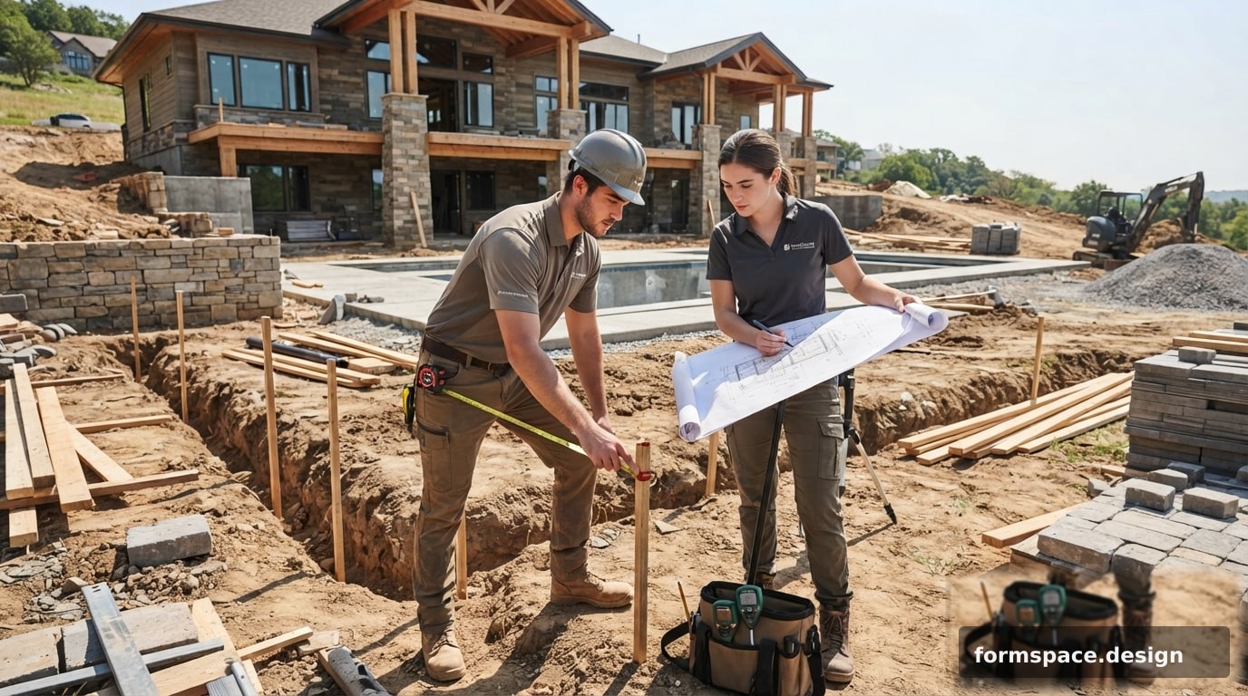
Grundstücksunterlage per Foto: So stellen Sie den Maßstab für eine präzise Planung ein
Erfahren Sie, wie Sie den Maßstab einer Grundstücksunterlage anhand eines Fotos für eine präzise Landschaftsplanung korrekt einstellen. Schritt-für-Schritt-Anleitung und häufige Fehler.
Die präzise Skalierung einer Grundstücksunterlage anhand eines Fotos ist das Fundament einer erfolgreichen Landschaftsplanung. Ohne den richtigen Maßstab können all Ihre Ideen, Materialberechnungen und Zonierungen in der Praxis nicht umgesetzt werden. Dieser Artikel hilft Ihnen, die Schlüsselprinzipien zu erlernen und häufige Fehler zu vermeiden, damit Ihr Projekt nicht nur schön, sondern auch funktional ist.
Warum ein präziser Maßstab für Ihr Grundstück wichtig ist
Ein korrekt eingestellter Maßstab der Unterlage ermöglicht es, die realen Abmessungen Ihres Grundstücks auf einen virtuellen Plan zu übertragen. Dies ist aus mehreren Gründen entscheidend. Erstens können Sie Flächen für Rasenflächen, Blumenbeete, Pflasterungen oder Teiche genau berechnen, was sich direkt auf die benötigte Materialmenge und das Budget auswirkt. Zweitens ermöglicht ein maßstabsgetreuer Plan die korrekte Platzierung von Objekten: Pavillons, Ruhezonen, Spielplätze, unter Berücksichtigung der erforderlichen Durchgänge und Abstände, z.B. ein 1 Meter breiter Weg oder ein 3 Meter Abstand zum Zaun. Schließlich hilft es, potenzielle Probleme frühzeitig zu erkennen, wie z.B. Platzmangel für gewünschte Elemente oder eine inkorrekte Anordnung funktionaler Bereiche, z.B. Parkplätze zu weit vom Eingang entfernt. Ein Fehler von nur 10-20% im Maßstab kann zu erheblichen Umgestaltungen und Zeitverlust führen.
Vorbereitung zur Skalierung: Was Sie wissen müssen
Bevor Sie mit der Skalierung beginnen, ist es wichtig, die Ausgangsdaten korrekt vorzubereiten. Als Unterlage können Luftbilder (von einer Drohne), Satellitenbilder oder sogar hochwertige Fotos verwendet werden, die von einem erhöhten Punkt, z.B. einem Hausdach, aufgenommen wurden und eine möglichst orthogonale Draufsicht bieten. Die Hauptbedingung ist das Vorhandensein mindestens eines Objekts auf dem Bild, dessen reale Abmessungen Ihnen genau bekannt sind. Dies kann ein Teil eines Zauns, eine Hauswand, die Breite eines Weges oder die Länge eines auf dem Grundstück geparkten Autos sein. Je genauer diese «Referenzlinie» vor Ort gemessen wird, desto höher ist die Genauigkeit der Skalierung. Vermeiden Sie Fotos, die in einem spitzen Winkel aufgenommen wurden, da diese starke perspektivische Verzerrungen aufweisen, die ohne spezielle Software nicht vollständig beseitigt werden können.
Schritt-für-Schritt-Anleitung: So stellen Sie den Maßstab anhand einer Referenzlinie ein
- Bestimmen Sie die Referenzlinie: Wählen Sie auf Ihrem Foto ein deutlich sichtbares Objekt mit einer bekannten realen Länge. Ideal ist ein gerader Zaunabschnitt, eine Hausseite oder ein bereits angelegter gerader Weg. Messen Sie dessen reale Länge auf dem Grundstück mit einem Maßband, z.B. 12 Meter.
- Messen Sie die Referenzlinie auf dem Foto: Laden Sie das Foto in die Planungssoftware. Verwenden Sie das «Lineal»- oder «Entfernungsmess»-Werkzeug, um die Länge desselben Objekts auf dem Bild in Pixeln oder relativen Einheiten zu messen. Angenommen, dieses Objekt ist auf dem Foto 500 Pixel lang.
- Berechnen Sie den Skalierungsfaktor: Teilen Sie die reale Länge durch die Länge in Pixeln (12 Meter / 500 Pixel = 0,024 Meter/Pixel). Dies ist Ihr Skalierungsfaktor: Jeder Pixel auf dem Foto entspricht 2,4 Zentimetern in der Realität.
- Wenden Sie den Maßstab an: Die meisten Landschaftsdesign-Programme verfügen über eine Funktion «Maßstab einstellen» oder «Kalibrierung». Sie teilen dem Programm mit, dass die auf dem Foto gemessene Linie von 500 Pixeln tatsächlich 12 Meter lang ist. Danach berechnet das Programm automatisch alle anderen Abmessungen auf der Unterlage neu. Stellen Sie sicher, dass nach dem Anwenden des Maßstabs andere bekannte Objekte auf dem Grundstück (z.B. eine Torbreite von 3,5 Metern) ihren realen Abmessungen im Plan entsprechen.
Was tun, wenn keine Referenzobjekte vorhanden sind?
Manchmal gibt es auf dem Foto keine offensichtlichen Objekte, deren reale Abmessungen Ihnen bekannt sind. In solchen Fällen können alternative Ansätze verwendet werden:
- Katasterplan: Wenn Sie einen Katasterplan des Grundstücks haben, können Sie diesen verwenden, um die Gesamtlänge einer der Grundstücksseiten zu bestimmen. Beachten Sie jedoch, dass Katasterpläne Ungenauigkeiten aufweisen können und ihre Präzision nicht immer für eine detaillierte Landschaftsgestaltung ausreicht. Verwenden Sie sie als Ausgangspunkt, aber überprüfen Sie die Maße nach Möglichkeit vor Ort.
- Temporäre Messungen: Sie können selbst eine Referenzlinie auf dem Grundstück erstellen. Stecken Sie zum Beispiel zwei Pfähle in einem bekannten Abstand (sagen wir, 10 Meter) voneinander in den Boden, machen Sie ein Foto von einem erhöhten Punkt, sodass die Pfähle sichtbar sind, und verwenden Sie diesen Abstand zur Skalierung. Diese Methode ist besonders nützlich für unregelmäßig geformte Grundstücke oder solche ohne klare Orientierungspunkte.
- Ungefähre Skalierung: Für die allerersten, konzeptionellen Skizzen können ungefähre Maße verwendet werden, basierend auf bekannten Standards (z.B. durchschnittliche Fahrzeugbreite ~1,8 m, Standardfliese 0,5x0,5 m). Für eine ernsthafte Planung ist dieser Ansatz jedoch nicht geeignet, und eine Präzisierung ist erforderlich. Für eine detailliertere Zonierung des Grundstücks lesen Sie unseren Artikel: So zonieren Sie Ihr Grundstück richtig: Ein praktischer Leitfaden.
Typische Fehler bei der Skalierung und wie man sie vermeidet
Auch bei Einhaltung der Grundregeln können Fehler auftreten, die die Genauigkeit Ihres Plans mindern:
- Perspektivische Verzerrungen: Die Verwendung von Fotos, die vom Boden aus oder in einem großen Winkel aufgenommen wurden, führt zu Größenverzerrungen. Objekte, die näher an der Kamera sind, erscheinen größer. Versuchen Sie immer, Aufnahmen zu verwenden, die möglichst von oben (orthogonal) gemacht wurden, um dieses Problem zu minimieren. Ist dies nicht möglich, wählen Sie eine Referenzlinie, die sich ungefähr in der Mitte des Bildes befindet und senkrecht zur Aufnahmerichtung steht.
- Ungenauigkeiten bei Referenzmessungen: Ein Fehler bei der Messung der realen Länge des Referenzobjekts auf dem Grundstück überträgt sich automatisch auf den gesamten Plan. Verwenden Sie ein hochwertiges Maßband und führen Sie die Messungen so sorgfältig wie möglich durch, eventuell zu zweit zur Kontrolle.
- Ignorieren des Reliefs: Wenn Ihr Grundstück erhebliche Höhenunterschiede aufweist, kann eine einfache Skalierung anhand eines flachen Fotos ungenau sein. Objekte an Hängen erscheinen kürzer oder länger, als sie tatsächlich sind. Für solche Grundstücke können komplexere geodätische Messungen oder die Verwendung von 3D-Modellen erforderlich sein.
- Geringe Fotoauflösung: Bilder mit geringer Auflösung erschweren die genaue Bestimmung von Objektgrenzen und die Auswahl der Referenzlinie. Versuchen Sie, hochwertige Fotos zu verwenden, auf denen Details klar erkennbar sind.
Überprüfung der Maßstabsgenauigkeit: Kontrollpunkte
Nachdem Sie den Maßstab anhand einer Referenzlinie eingestellt haben, ist es äußerst wichtig, dessen Genauigkeit anhand anderer bekannter Objekte auf dem Grundstück zu überprüfen. Dies wird als Verwendung von Kontrollpunkten bezeichnet. Messen Sie im Plan mehrere andere Objekte, deren reale Abmessungen Ihnen ebenfalls bekannt sind (z.B. die Breite des Hauses, die Länge eines Gartenweges). Vergleichen Sie die erhaltenen Werte im Plan mit ihren tatsächlichen Abmessungen. Wenn die Abweichungen minimal sind (innerhalb von 10-20 cm für die Landschaftsgestaltung oder 1-2 cm für Bauarbeiten), ist der Maßstab korrekt eingestellt. Gibt es erhebliche Unterschiede, müssen Sie den Skalierungsprozess möglicherweise wiederholen, indem Sie eine andere Referenzlinie oder genauere Messungen verwenden. Manchmal ist eine iterative Anpassung erforderlich, um die bestmögliche Genauigkeit zu erzielen. Eine durchdachte Planung von Gartenwegen hängt beispielsweise stark von der Maßstabsgenauigkeit ab, mehr dazu in unserem Artikel: So planen Sie Gartenwege auf Ihrem Grundstück.
So planen Sie in formspace.design mit einer skalierten Unterlage
formspace.design vereinfacht den Prozess der Landschaftsplanung erheblich, insbesondere wenn es um die Arbeit mit Unterlagen geht. Um mit einem Foto Ihres Grundstücks zu beginnen, können Sie das Modul 3.1 Design nach Foto verwenden. Laden Sie ein hochwertiges Luftbild oder Satellitenbild Ihres Grundstücks hoch. Nach dem Hochladen suchen Sie auf dem Bild ein Objekt, dessen reale Länge Sie kennen – dies kann eine Zaunlänge von 20 Metern, eine Hauswand von 10 Metern oder sogar die Breite eines Garagentors von 3,5 Metern sein. Verwenden Sie das integrierte Werkzeug zur Maßstabskalibrierung, markieren Sie den Start- und Endpunkt dieses Objekts auf dem Bild und geben Sie dessen reale Größe ein. Das System skaliert die gesamte Unterlage automatisch, und alle nachfolgenden Messungen und Objekte werden in realen Größen angezeigt.
Nachdem die Unterlage skaliert wurde, wechseln Sie zum Modul 1.x Grundstücksplan. Hier können Sie auf Basis der präzisen Unterlage Zonen erstellen (z.B. Ruhezone, Gemüsegarten, Spielplatz), Objekte platzieren (Bäume, Sträucher, Teiche, kleine architektonische Formen) und Wege planen, wobei Sie deren reale Abmessungen kennen. Wenn Sie beispielsweise ein 1200 m² großes Grundstück haben und einen 3x4 Meter großen Pavillon darauf platzieren möchten, können Sie genau sehen, wie viel Platz er einnimmt und wie sich dies auf die anderen Elemente auswirkt. Das Modul 2.1 KI-Konzept kann auch zur Ideengenerierung verwendet werden, aber für die besten Ergebnisse wird empfohlen, zuerst einen Basisplan mit präzisem Maßstab zu erstellen, damit die KI Lösungen vorschlägt, die den realen Abmessungen und Besonderheiten Ihres Grundstücks entsprechen.
Häufig gestellte Fragen
Können Satellitenbilder zur Skalierung verwendet werden?
Ja, Satellitenbilder können als Unterlage für die Planung verwendet werden. Ihre Genauigkeit kann jedoch je nach Anbieter und Bildauflösung variieren. Für eine detaillierte Planung wird immer empfohlen, den Maßstab anhand mehrerer Kontrollpunkte auf dem Grundstück zu überprüfen, da Satellitendaten leichte geometrische Verzerrungen aufweisen können.
Wie genau muss der Maßstab sein?
Für die Landschaftsgestaltung und allgemeine Grundstücksplanung ist eine Abweichung von 10-20 Zentimetern über große Entfernungen in der Regel akzeptabel. Für Bauarbeiten, wie die Errichtung eines Fundaments oder die Verlegung von Versorgungsleitungen, ist jedoch eine Genauigkeit von 1-2 Zentimetern erforderlich. Streben Sie stets die höchstmögliche Genauigkeit an, basierend auf den verfügbaren Werkzeugen und Ausgangsdaten.
Was tun, wenn das Grundstück ein komplexes Relief aufweist?
Ein komplexes Relief kann die Perspektive auf flachen Fotos verzerren. In solchen Fällen wird empfohlen, mehrere Referenzpunkte auf verschiedenen Ebenen zu verwenden oder, falls möglich, auf geodätische Daten zurückzugreifen. Für eine präzise Planung auf Grundstücken mit Höhenunterschieden ist es am besten, spezielle Software zu verwenden, die mit 3D-Geländemodellen arbeiten kann, oder den Plan in Abschnitten zu erstellen.
Kann der Maßstab nach Beginn der Planung geändert werden?
Technisch kann der Maßstab jederzeit geändert werden, dies ist jedoch äußerst unerwünscht, nachdem Sie begonnen haben, Objekte zu platzieren und Zonen zu erstellen. Eine Maßstabsänderung führt zu einer Verzerrung der Größen aller bereits platzierten Elemente. Daher ist es entscheidend, den Maßstab zu Beginn der Projektarbeit so genau wie möglich einzustellen, um Überarbeitungen und Verwirrung zu vermeiden.
Welche Mindestanforderungen gibt es an Fotos zur Skalierung?
Für eine effektive Skalierung sollte das Foto eine ausreichend hohe Auflösung haben, um Referenzobjekte und Grundstücksgrenzen klar unterscheiden zu können. Es ist wichtig, dass die Aufnahme möglichst orthogonal (Draufsicht) erfolgt, um perspektivische Verzerrungen zu minimieren. Das Fehlen von Schatten, die wichtige Bereiche verdecken, verbessert ebenfalls die Arbeitsqualität.
Wie stelle ich den Maßstab schnell ein, wenn ich nicht viel Zeit zum Messen habe?
Wenn die Zeit begrenzt ist, wählen Sie das offensichtlichste und am einfachsten zu messende Objekt auf dem Grundstück (z.B. die längste Hauswand oder einen geraden Zaunabschnitt). Messen Sie es einmal so genau wie möglich. Dies bietet eine Basiskalibrierung. Für höhere Geschwindigkeit können Satellitenbilder mit bekannten Grundstücksgrößen aus dem Kataster verwendet werden, jedoch unter Berücksichtigung möglicher Ungenauigkeiten.
Beeinflusst die Fotoqualität die Genauigkeit der Skalierung?
Ja, die Qualität des Fotos beeinflusst direkt die Genauigkeit der Skalierung. Geringe Auflösung, Unschärfe, starke Schatten oder Reflexionen können die genaue Bestimmung der Referenzlinie und anderer Objekte erschweren. Je schärfer und detaillierter das Bild ist, desto einfacher und präziser wird der Prozess der Maßstabskalibrierung und der nachfolgenden Planung sein.
Die korrekte Skalierung der Unterlage ist nicht nur ein technischer Schritt, sondern der Schlüssel zur erfolgreichen Umsetzung Ihres Landschaftsprojekts. Indem Sie diesem Prozess von Anfang an genügend Aufmerksamkeit schenken, sparen Sie in Zukunft Zeit, Geld und Nerven. Nutzen Sie formspace.design für die bequeme Arbeit mit Unterlagen und verwandeln Sie Ihre Ideen in die Realität, indem Sie Schritt für Schritt Ihr Traumgrundstück gestalten.
Veröffentlicht:

Volodymyr Vybornyi
Landschaftsdesigner, Gründer von https://formspace.design/
Schreibt über Landschaftsdesign, Business und moderne computergestützte Planungswerkzeuge für Landschaften – einschließlich KI.